Tuesday, August 15, 2006

LoSoNet 2006 Makes P2P Connections

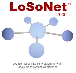
There's a new conference in town - Location-Based Social Networking (LoSoNet™) for Crisis Management. LoSoNet 2006 will be held at the prestigious Sheraton National in Arlington, Virginia on Tuesday, October 3, 2006.


LoSoNet 2006 provides a forum to connect the world of social networking with location-based information. The conference focuses on emerging methods to achieve situational awareness for defense and homeland security programs. The conference also examines how peer and ad hoc networks can provide new levels of situational awareness, fusion and survivability that rigid command and control hierarchies can't match. New approaches to improve situational awareness, including emergent intelligence, will be highlighted in this unique forum.

The speakers will highlight how federal, state, tribal and local stakeholders can accomplish the following -

- Share and search information about locations of interest

- Connect to and collaborate with groups of peers with similar information needs

- Break down barriers to information sharing and situational awareness

- Build resilient communities and networked organizations

- Achieve and improve situational awareness in the mission critical areas of prevention, protection, response, recovery and preparedness

For more information or to register please visit www.LoSoNet.org.

This work is licensed under a Creative Commons Attribution-Noncommercial-No Derivative 2.5 License and is copyrighted (c) 2006 by The Carbon Project.

Tuesday, August 08, 2006

CarbonCloud in Vancouver


Had the chance to take CarbonCloud on the road some more - this time to GeoWeb 2006 in Vancouver, British Columbia.

The weather was awesome and Vancouver is a great place to try out CarbonCloud on a few more systems. We even gave a live demo during my talk on Thursday - the UMPCs, Notes, and P2P connections all worked great, and the sushi place was good too.

Sample screenshot is included above - I'll try to upload some higher quality shots when I get some time. The background image is from the GlobeXplorer ImageConnect WMS.

This work is licensed under a Creative Commons Attribution-Noncommercial-No Derivative 2.5 License and is copyrighted (c) 2006 by The Carbon Project.

Monday, August 07, 2006

Democratic Access Revisited, Google Blinds Competition?

A few months ago I wrote a post about Democratic Access to location content saying -

"Google, Yahoo and Microsoft have all started providing different kinds of location content to consumers and technical folks alike through mapping services, allowing a bit more "democratic" access to location-based content. But I suppose the Google, Yahoo and Microsoft approach is to own as much data as money can buy. However, another approach is to facilitate the viewing and sharing of any location content available in the new Internet democracy, wherever (or whoever) it comes from."

It seems the discussion was a bit more 'prescient' than I thought - a recent post on the Geowanking mail list claims that Google has -

"licensed ALL of Digital Globe's imagery on an exclusive basis for online presentation"

This could effectively blind the online competition in many cases - no imagery, no pretty maps.

The post does go on to say that Digital Globe referred the requestor to GeoEye, another commercial satellite imaging company and their competitor.

Democratic access indeed.

This work is licensed under a Creative Commons Attribution-Noncommercial-No Derivative 2.5 License and is copyrighted (c) 2006 by The Carbon Project.


((Echo))MyPlace in GISCafe

GISCafe recently did an article on the prototyping we're doing on ((Echo))MyPlace and CarbonCloud, including some classic quotes from the team...
“It's sort of like a real time, real place Myspace, with maps,”

Read more


This work is licensed under a Creative Commons Attribution-Noncommercial-No Derivative 2.5 License and is copyrighted (c) 2006 by The Carbon Project.